Search
Logan County, Colorado

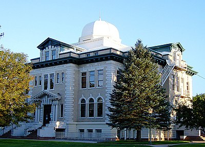
Logan County is a county located in the U.S. state of Colorado. As of the 2020 census, the population was 21,528. The county seat is Sterling. The county was named for General John A. Logan.
Logan County comprises the Sterling, CO Micropolitan Statistical Area.
Geography
According to the U.S. Census Bureau, the county has a total area of 1,845 square miles (4,780 km2), of which 1,839 square miles (4,760 km2) is land and 6.3 square miles (16 km2) (0.3%) is water.
Adjacent counties
Major highways
- Interstate 76
- I-76 BS
- U.S. Highway 6
- U.S. Highway 138
- State Highway 14
- State Highway 61
- State Highway 63
- State Highway 113
Transit
- Burlington Trailways
- Express Arrow
State protected area
- North Sterling State Park
Trails and byways
- American Discovery Trail
- Pawnee Pioneer Trails
- South Platte Trail
Demographics
At the 2000 census there were 20,504 people, 7,551 households, and 5,066 families in the county. The population density was 11 people per square mile (4.2 people/km2). There were 8,424 housing units at an average density of 5 per square mile (1.9/km2). The racial makeup of the county was 91.65% White, 2.05% Black or African American, 0.64% Native American, 0.40% Asian, 0.07% Pacific Islander, 3.77% from other races, and 1.43% from two or more races. 11.90% of the population were Hispanic or Latino of any race. Of the 7,551 households 31.90% had children under the age of 18 living with them, 54.80% were married couples living together, 8.60% had a female householder with no husband present, and 32.90% were non-families. 28.50% of households were one person and 12.40% were one person aged 65 or older. The average household size was 2.45 and the average family size was 3.02.
The age distribution was 24.70% under the age of 18, 10.80% from 18 to 24, 28.30% from 25 to 44, 21.70% from 45 to 64, and 14.50% 65 or older. The median age was 36 years. For every 100 females there were 112.00 males. For every 100 females age 18 and over, there were 114.60 males.
The median household income was $32,724 and the median family income was $42,241. Males had a median income of $28,155 versus $21,110 for females. The per capita income for the county was $16,721. About 9.00% of families and 12.20% of the population were below the poverty line, including 13.40% of those under age 18 and 10.90% of those age 65 or over.
Politics
Logan County is strongly Republican in presidential elections. Since 1888, the county has failed to back the Republican candidate in only six presidential elections, most recently in 1964 in the midst of Lyndon B. Johnson's national landslide victory.
Communities
City
- Sterling
Towns
- Crook
- Fleming
- Iliff
- Merino
- Peetz
Census-designated places
- Atwood
- Padroni
Unincorporated communities
- Dailey
- Proctor
- Willard
Ghost towns
See also
- Bibliography of Colorado
- Geography of Colorado
- History of Colorado
- National Register of Historic Places listings in Logan County, Colorado
- Index of Colorado-related articles
- List of Colorado-related lists
- List of counties in Colorado
- List of statistical areas in Colorado
- Outline of Colorado
References
External links
- Official website
- Colorado County Evolution by Don Stanwyck
- Colorado Historical Society
Text submitted to CC-BY-SA license. Source: Logan County, Colorado by Wikipedia (Historical)
Articles connexes
- Logan County
- Sterling, Colorado
- John A. Logan
- Logan County Courthouse (Colorado)
- Padroni, Colorado
- Interstate 76 (Colorado–Nebraska)
- Peetz, Colorado
- Iliff, Colorado
- Atwood, Colorado
- Merino, Colorado
- List of counties in Colorado
- South Platte River
- Crook, Colorado
- List of municipalities in Colorado
- Weld County, Colorado
- Colorado State Highway 14
- List of Colorado municipalities by population
- U.S. Route 138
- Fleming, Colorado
- Jerry Sonnenberg
Owlapps.net - since 2012 - Les chouettes applications du hibou


